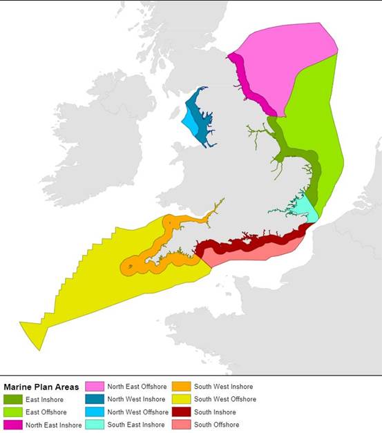
Marine Development BlogMarine developments: news and updates about marine planning and licensing2026-07-21T12:57:52Zhttps://marinedevelopments.blog.gov.uk/feed/Lucy Jackson, Marine Planner<![CDATA[The Marine Management Organisation want to hear about your experience of using the marine plans]]>https://marinedevelopments.blog.gov.uk/?p=51032026-07-21T12:57:52Z2026-07-20T09:36:19ZAre you a decision-maker or a proponent in one of England’s marine plan areas? Do you have experience of using the marine plans in another capacity, or a strong interest in marine planning in England?
The Marine Management Organisation (MMO) have just launched the latest monitoring survey for all marine plan areas in England, providing an opportunity for stakeholders to feedback on marine plan application and effectiveness. The monitoring survey is open until 11 September 2026.
We are interested in how the marine plans are being used to inform development of terrestrial local plans. We are also interested in how they are being applied in development management. Your feedback is important to us.
The monitoring survey is your opportunity to tell us how marine plan policy is being considered at all stages of the application process and in the formation of local plans and development.
Marine plan policies cover a varied range of activities that support the sustainable development of our marine environment, from aquaculture to aggregates, renewables to seascape, and ports and shipping to tourism and recreation.
Information on marine plan policy can be viewed spatially on our Explore Marine Plans interactive digital tool.
The monitoring survey will close on Friday 11 September 2026
The survey should take about 30 minutes to complete. It does not have to be completed it in a single session, you can leave and return to it later (provided you use the same computer and you do not delete your browser history).
Your activity may occur in an area which occurs in multiple marine plan areas, in which case we would greatly appreciate your responses to the survey for both areas by selecting all relevant marine plans.
Please complete your survey in full before submitting, as we are unable to accept partially completed surveys.
]]>0Kathleen Telford, Marine Planner<![CDATA[Marine Planning team explore the North Yorkshire Coast to see the benefits of Marine Plan policy]]>https://marinedevelopments.blog.gov.uk/?p=50962026-07-15T10:16:33Z2026-07-15T09:46:12Z
The Marine Planning team is dispersed across England. Bringing colleagues together provides an opportunity to share knowledge and gain a greater understanding of how marine planning benefits local communities, businesses, and wildlife. In June, the team visited the North Yorkshire Coast to explore some of these topics.
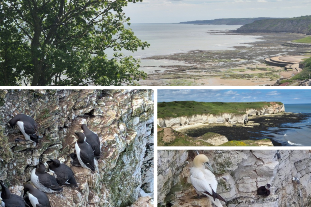
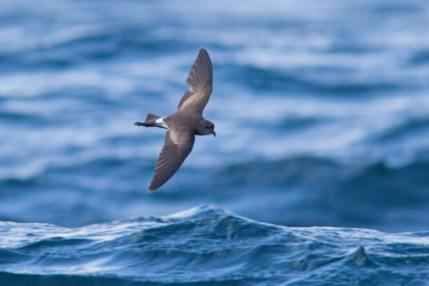
Our first stop was a site visit to RSPB Bempton Cliffs Reserve, one of the UKs most impressive seabird colonies. The white chalk cliffs are home to nesting gannets, guillemots, razorbills, herring gulls, and puffins amongst other species, and hosts the largest population of mainland seabirds in the UK.
The colony has benefited from the closure of the commercial sand eel fishery with sand eels being an important food source for many seabird species, supporting breeding success in the region. The chalk grasslands along this section of coastline are also a designated Site of Special Scientific Interest (SSSI), protected due to the number of specialist plants that create important nesting habitats.
The team then travelled further down the coast to Flamborough Head, a Special Area of Conservation (SAC) and Special Protection Area (SPA) designated for its internationally important habitats and bird populations. The Yorkshire Marine Nature Partnership joined us at the site and shared their seasonal challenges and experience with managing the Marine Protected Areas (MPAs) though partnership working, collaboration and evidence gathering.
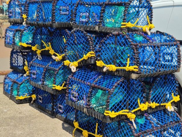
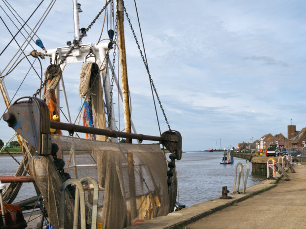
At Bridlington Harbour, we had an overview of the work completed by North Easten IFCA which was our final stop on day one. They shared the impact of the Shellfish Permit Byelaw which imposes a maximum of 1,000 commercial pots for crab and lobster, the local areas main catch, to support the sustainable management of shellfish fisheries.
A dawn visit aboard the SeaGrown vessel provided an opportunity to see their 25-acre seaweed farm off the Scarborough coast on day two. SeaGrown’s work highlights how marine activities can be planned and managed to deliver environmental, social, and economic benefits in the same space. Their Kelpedo seaweed cultivation system aims to support biodiversity, improve water quality, and create habitat for marine wildlife, demonstrating a practical example of sustainable co-existence in the marine environment.
Throughout the visit, the team saw examples of how marine planning and wider marine management measures support the sustainable use of marine space while protecting and enhancing the natural environment. These outcomes closely align with the objectives of marine plans, which seek to balance environmental, social, and economic benefits for current and future generations.
These site visits energised the team and demonstrated how activities in and around the coast support marine and coastal ecosystems, contributing to carbon sequestration, enhanced biodiversity, and improved socio-economic benefits though tourism, and community wellbeing.
The visit demonstrated several key themes reflected in marine plan policies, including biodiversity enhancement, sustainable fisheries management, and the coexistence of environmental restoration with tourism and recreation.
Thank you to everyone involved for your time and for sharing your expertise and demonstrating the positive difference being made in the marine and coastal environment.
]]>0Kathleen Telford, Marine Planner<![CDATA[Marine Licensing Top Tips: Improving Clarity, Communication and Efficiency]]>https://marinedevelopments.blog.gov.uk/?p=50912026-07-09T09:08:31Z2026-07-08T09:01:21Z
The Marine Management Organisation (MMO), working alongside the ports sector, has launched new Marine Licensing Top Tips, as well as practical tools to make the licensing process clearer and more efficient.
Developed under the Ports Sandbox initiative with the UK Major Ports Group, the guidance incorporates input from applicants, regulators, and statutory consultees. It aims to increase transparency, reduce delays, and support efficient applications.
The step-by-step guidance covers the full process, from pre-application engagement to final decisions. It also highlights key requirements, common challenges, and best practices.
A process flowchart outlining each stage and the required applicant input.
Together, these resources encourage earlier collaboration and clearer communication between applicants, consultees, and MMO case teams.
The MMO acknowledges contributions from partners including the UK Major Ports Group, Port of Bristol, Associated British Ports, DP World, and Natural England. The guidance will remain a “living resource,” updated through the Marine Planning and Licensing Programme, helping to deliver a more consistent and predictable licensing process.
The Strategic Renewables Unit (SRU) has been progressing work on a range of cross-cutting offshore wind issues, including underwater noise management, environmental compensation, and decommissioning. The SRU also presented at the East Marine Ecosystems Conference in Lincoln and will be presenting at the Structures in the Marine Environment Conference in Newcastle. For more details on our work on underwater noise and environmental compensation, please see below.
Collaborative Management of Underwater Noise
The Southern North Sea Special Area of Conservation (SNS SAC) is designated to protect harbour porpoise, meaning underwater noise from offshore development must be carefully managed in the area. Jointly run by the Offshore Petroleum Regulator for Environment and Decommissioning (OPRED) and the Marine Management Organisation (MMO), the Development Coordination Forum (DCF) brings regulators and developers together to coordinate offshore projects and avoid exceeding the JNCC underwater noise disturbance thresholds within this site.
Introducing the Dispute Resolution Process
On the recommendation of the Xodus Conflict Resolution Report, the MMO and OPRED have recently developed and implemented the Dispute Resolution Process (DRP), now embedded in the DCF framework. The DRP has established a clear, structured approach for resolving scheduling conflicts between projects to avoid threshold breaches. The DRP is a key tool used to support compliance and protect the site, whilst also enabling continued expansion of offshore energy.
Testing the DRP – Rehearsal of Concept
Ahead of the SNS SAC 2026 summer season (1 April–30 September), OPRED and the MMO led a Rehearsal of Concept with the current DCF participants to test and refine the DRP. During the one-day exercise, participants used a fictional dispute scenario to work through each stage of the DRP and reach a coordinated resolution. The hands-on approach introduced the process to DCF participants, tested communication channels, and demonstrated timelines and regulatory decision-making. Insights from the exercise are informing ongoing developments to the DRP, focusing on communication, procedural clarity, and developer and regulator readiness.
Environmental Compensation Reform
On 21 May, the Environmental Compensatory Measures Reforms Statutory Instrument was laid. These reforms enable a broader range of ways for offshore wind developers to compensate for any unavoidable impact their projects have on protected sites. Compensation measures can now be more strategic. Defra has published guidance on when and how to compensate for environmental harm, as well as guidance on the newly introduced compensation hierarchy and the evidence required: Offshore wind: compensating for environmental harm - GOV.UK.
The SRU, on behalf of the MMO, coordinated the MMO's input into these reforms, drawing on our knowledge and ensuring the reforms fit with our regulatory remit.
]]>0Kathleen Telford, Marine Planner<![CDATA[East Marine Plan Engagement Events Bring Together More Than 160 Participants]]>https://marinedevelopments.blog.gov.uk/?p=50832026-07-09T09:01:53Z2026-07-03T12:26:46Z
Stakeholders from across England joined two online events to hear the latest updates on the East Marine Plan and help shape future engagement activities.
As part of ongoing engagement on the development of the East Marine Plan, the Marine Planning team held two online events on 17 and 18 March for interested stakeholders and members of the public. A total of 162 participants attended from a range of sectors, including local planning authorities, ports, the fishing industry, environmental organisations, consultants, non-governmental organisations (NGOs), and members of the public.
This provided an opportunity to update participants on policy development, including how feedback received during the Autumn 2025 engagement has informed the emerging plan, as well as the overall progress made to date. In addition to sharing updates, two Mentimeter Q&A sessions were held to gather views on future engagement approaches and to better understand how marine plans are currently being used by stakeholders. Participants were also invited to share suggestions on how marine plans could be made more accessible and effective.
The events generated valuable discussion and feedback, which will help inform future engagement activities as the East Marine Plan continues to develop.
Coastal Planners across England continue to support marine planning, stakeholder engagement, and future skills development. The following highlights some of the work undertaken across regions during the last quarter.
South East
As part of the development of the new East Marine Plan, Marie Canny has been working with the GIS team to produce a suite of maps that will support the plan. These include both overview maps of the plan area and detailed maps that provide evidence for individual policies.
The maps will present key information in an accessible visual format, making it easier for users to understand the evidence that underpins the plan.
Ongoing engagement with stakeholders has helped ensure the maps accurately reflect activities, opportunities, and constraints across the marine area. Combining stakeholder knowledge with technical mapping expertise is helping to support the development of practical, evidence-based policies.
North East
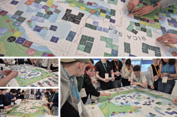
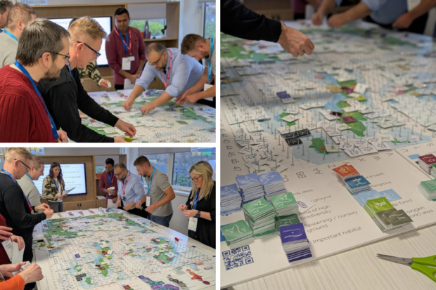
Amy Hodgson, Sophia Yakoob and Kathleen Telford have been working with students from Northumbria University and Newcastle University through a series of Marine Spatial Planning (MSP) Challenge workshops. The sessions gave students the opportunity to explore the complexities of marine planning and the competing demands placed on our marine environment.
Between 18 and 27 students attended each session, demonstrating strong engagement throughout. Each group approached the planning scenarios differently, reflecting the real-world skills required to develop marine plans and policies, including collaboration, evidence-based decision-making, and effective communication.
The workshops provided valuable insight into the challenges marine planners face when balancing competing interests and highlighted the importance of taking an integrated approach to managing marine and coastal areas. These sessions form part of our wider commitment to supporting future marine planning professionals and increasing understanding of marine planning.
South
Sidonie Kenward and Eva Turley recently met with MSc students at the University of Brighton to deliver an adapted version of the Marine Spatial Planning (MSP) Challenge. While the full exercise is usually delivered over a longer period, the shortened format enabled participants to gain an introduction to key marine planning concepts within a limited timeframe.
The session focused on the development of a freeport and encouraged students to consider how activities such as tourism, recreation and renewable energy can be affected by new developments. A particular focus was competition for space within the marine environment, highlighting the challenges of balancing multiple uses in the same area.
Many participants were future land-use planners, making the session especially valuable in promoting understanding between marine and land-use planning systems. Building these connections early supports more joined-up and sustainable decision-making in the future.
North West
Chloe Boyle and Mark Maguire have been working closely with regional Marine Ecosystem groups (SWME, EastME and NWME), which provide a platform for organisations, networks, and individuals to share knowledge and discuss the state of the marine environment.
These groups help strengthen collaboration between stakeholders, support evidence gathering and identify opportunities to inform future policy and strategy. They also provide valuable opportunities for the Marine Management Organisation to engage with partners working across different sectors and regions.
Over recent months, Chloe Boyle, Mark Maguire, Rosie Bailey, and Poppy Philipps have contributed to a range of Marine Ecosystem activities, including presentations at regional conferences and support for annual reporting. Their work has helped maintain strong relationships with stakeholders while sharing updates on marine planning activity and encouraging continued collaboration across the marine sector.
]]>Dan Cutler, Communications & Engagement Manager<![CDATA[Two years of MPA protection: reflecting on a milestone for England's marine protected areas]]>https://marinedevelopments.blog.gov.uk/?p=50502026-04-01T14:34:45Z2026-03-23T14:12:50ZTwo years ago we took a significant step towards healthier seas and a more sustainable future for our fishing industry.
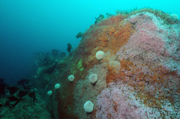
On 22 March 2024, new rules came into force prohibiting the use of bottom towed fishing gear across reef and rocky habitats in 13 English offshore marine protected areas (MPAs). This protected almost 4,000 square kilometres of seabed from damaging fishing activity.
These MPAs are home to some of our most fragile and precious marine habitats and species, including pink sea fan colonies, Ross worm reefs and delicate sponges. Their protected features are essential for a functioning marine ecosystem. They support the wider food chain and, in turn, the commercial fish stocks that fishing communities depend on.
These rules were delivered through MMO’s Stage 2 MPA byelaws and are part of our ambitious programme to protect all English offshore MPAs from damaging fishing activity.
When they came into force in 2024, the total area of our seas covered by MMO byelaws rose to almost 18,000 square kilometres - an area larger than Yorkshire and Kent combined.
Compliance and enforcement
We’re proud to report that compliance with MPA byelaws is consistently high. Incursions into closed areas are relatively rare, and repeat offences are even rarer. This is testament to our successful approach and the adaptability of our fishing industry who we thank for their continued commitment to marine conservation by following these rules.
This was the most extensive and complex MPA consultation we have ever undertaken, with the total area of seabed that would be protected by our proposals being around 30,000 km².
Launched on 9 June 2025, the consultation ran for sixteen weeks. This is the longest and most extensive MPA consultation we've run to date, recognising feedback from industry that more time would be needed to fully understand and response to our proposals
We grouped the MPAs included into regions and sought views on four proposed regional byelaws aimed at protecting sensitive habitats and species across 42 of England's MPAs.
We remain grateful to everyone who took part through our online survey, virtual meetings and in-person events held around the coast.
A record number of responses were received. We continue to review all submissions to ensure that all views and additional evidence are fully considered before any decisions are made on future management measures.
We appreciate that everyone's patience while this process continues and will provide updates, including details of our next steps, as soon as they are available.
The MMO is assessing and will consider management measures for offshore marine protected areas (MPAs) designated for harbour porpoise and marine birds.
In Autumn 2025 we gathered further evidence and views on options to manage harbour porpoise bycatch in:
Southern North Sea MPA
Bristol Channel Approaches MPA
Thank you to everyone who has already shared early views on our potential management options. This is an important step before we consider a future formal consultation.
]]>Sarah Allison, Integrated Marine Manager<![CDATA[Reflections on Coastal Futures 2026]]>https://marinedevelopments.blog.gov.uk/?p=50402026-03-06T09:59:06Z2026-03-05T09:30:35ZSarah Allison, Integrated Marine Manager, reflects on the highlights, conversations and takeaways from Coastal Futures 2026.
This year’s Coastal Futures conference took place on the 28 and 29 January in the Royal Geographical Society building in Kensington. If you haven’t been before, Coastal Futures is essentially the big meet‑up for anyone working in or interested in the marine sector. Over two days, the conference brings together practitioners, policymakers, academics, NGOs, filmmakers, and grassroots groups, all talking about the issues facing our seas and importantly, the creative ways people are solving them.
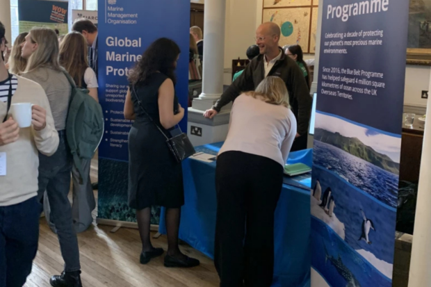
Jamie Davies at MMO's stand
The theme for this year’s conference was ‘From Ambition to Action’ which shaped the presentations across both days. Discussions focused on translating high‑level goals into practical solutions. Key themes woven throughout were sustainable blue growth, coastal resilience and community wellbeing, marine spatial planning, and action and accountability.
The conference opened with a ministerial address from Emma Hardy, Minister for Water and Flooding (including domestic and international marine), who emphasised practical delivery alongside political ambition. From there, each themed session dug into different parts of the marine sectors: collaborative conservation efforts, community led coastal adaptation, the challenges of marine spatial planning, and the realities of balancing blue growth across industries. Speakers represented organisations such as Defra, the RSPB, IFCAs, The Crown Estate, the Environment Agency and consultancies such as AtkinsRealis and ABPMer.
Day two began with a keynote from Natalie Prosser (Office for Environmental Protection) followed by a panel discussion titled ‘Robust evidence to actionable policy’ highlighting the need for strong evidence to inform decisions, while recognising that decisions need to be made using the best information available at the time. Later sessions focused on ‘Balancing Blue Growth’, examining marine policy and regulation from the perspective of development sectors such as shipping, offshore wind, and aggregates. The key takeaway was that developers are generally very supportive of stronger environmental regulation and more robust evidence gathering. What they’re less keen on is sudden shifts in policy direction, which create uncertainty and, ultimately, extra costs.
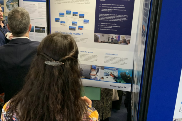
Blue Belt Progamme poster
As always, MMO was there as an annual sponsor showcasing the work we’re doing across England and internationally. This year was an opportunity for the Global Marine team (GMT) to present our work through a dedicated poster focusing on sustainable blue economies and our stand complete with beautiful footage of fish, sharks, turtles and crustaceans found in the UK Overseas Territories – which drew significant interest. The footage helped highlight the importance of the work we do in GMT and provided a real sense of the impact the programme has. We spoke with journalists, filmmakers, students, and marine professionals, all keen to understand more about how we undertake our international work.
Personal reflections: For MMO and GMT in particular, it was a brilliant opportunity to share what we’ve been working on. I was genuinely impressed by how many people were curious about our international work, and by the breadth of questions we received throughout the event. Speaking to hundreds of delegates over two days is both uplifting and, admittedly, a little exhausting, but it’s also a powerful reminder of what we do and why we do it, and how much energy there is behind protecting and managing our shared marine environment.
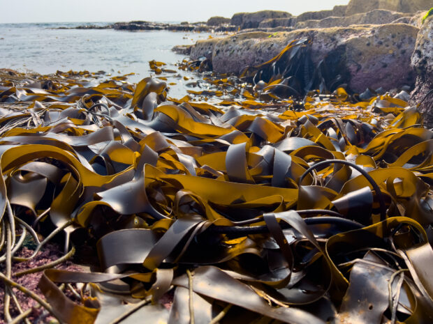
]]>Kathleen Telford, Marine Planner<![CDATA[Coastal Planners Corner]]>https://marinedevelopments.blog.gov.uk/?p=50372026-03-05T09:37:12Z2026-03-03T07:58:33ZClose-up shot of tangled seaweed washed up on the shore taken by the sea in Northumberland.
North East
In recent months, Kathleen had been focusing on developing the employment and heritage assets policies for the East Marine Plan. This has been a collaborative process, as we refine policies based on stakeholder feedback and insights from an independent Sustainability Assessment. The aim is to ensure the plan supports economic opportunities, protects cultural identity, and promotes long-term environmental sustainability. Work on these policies will continue, and they will be shared with you to ensure the final plan is the best it can be.
Alongside this, Kathleen has been responding to consultations from Northumberland, Gateshead, North Tyneside, and Whitby. In addition, several neighbourhood plans needed her input to support those in their endeavours to produce plans that are both wanted and needed, and reflect the priorities of their communities. This work helps to align local priorities with marine planning and the sustainable use of our marine area.
East
Mark has been continuing to develop policy, checking policy compatibility alongside responding to consultations and contributing to the development of the EastME conference, whilst attending regular meetings.
South East
As part of East Marine Plan development, Marie has been specifically working on the Defence and Fisheries policies, including Sustainability Appraisal mitigation and integrating previous stakeholder comments into our new draft policies.
As part of her focus on fisheries policy, Marie joined the All Party Parliamentary Group (APPG) on Fisheries, Rebuilding Trust: Fisheries, Science, Management. Trust between industry, scientists, managers, and policymakers is key to effective fisheries management. This session brought together experts on this topic and best practice case studies to explore the issues and to set out recommendations in support of fostering, and rebuilding the bridges of trust needed for sustainable, resilient and prosperous UK fisheries.
South
Eva has been busy continuing work on the East Marine Plan. She has attended meetings related to Shoreline Management Plans and is also looking into how these plans interact and align with marine plans in the South and South-West.
Eva attended a workshop with Sussex Bay where they are gathering information for their ‘blueprint for seascape recovery’. It was a very interesting workshop with voices from regulators, industry and Non-Governmental Organisations (NGOs). Having many voices from different perspectives is always an interesting and useful exercise which will hopefully support Sussex Bay in realising their vision.
North West
Over winter, the North West Coastal Forum and the Solway Firth Partnership hosted several online meetings with a range of stakeholders to understand how people's experiences of marine planning and the Local Nature Recovery Strategy processes could inform direction on the appropriate scale and governance for localised marine planning following the local approach to decision-making research project. This work was supported by Chloe in the North West.
The next step is a cross-sector workshop to share and explore the findings from the online sessions
]]>Amy Hodgson, Marine Planner<![CDATA[Exploring Opportunities to Improve Integration Between Marine Planning and Licensing]]>https://marinedevelopments.blog.gov.uk/?p=50332026-03-02T09:14:05Z2026-03-02T09:13:51Z
Recently, the Marine Planning team worked with colleagues in Planning and Change to deliver a half-day workshop focused on:
Understanding marine plans and their role in sustainably managing England’s marine environment.
Exploring how the new licensing service could better support plan-led licensing and wider marine planning needs, such as providing evidence to support marine plan monitoring and evaluation.
The workshop included a highly participatory MSP Challenge session, where participants navigated the trade-offs and opportunities involved in balancing sector priorities with government priorities in the marine environment.
The workshop concluded with a structured discussion on how an integrated service could operate in the future to better support the UK government in achieving its vision for clean, healthy, safe, productive, and biologically diverse oceans and seas.