A delegation from the UK Government's Blue Belt programme recently visited Tristan da Cunha to discuss progress, engage with the local community and establish next steps.
Hi, I am Dr Martin Collins, Principal Scientist, in the Blue Belt Programme, based in the Centre for Environment, Fisheries & Aquaculture Science. As part of the Blue Belt initiative, Cefas and the Marine Management Organisation (MMO) are working together with the UK Overseas Territories to provide long term protection of over four million square kilometres of marine environment.
In my role as Science Lead for the Atlantic territories I recently joined my colleagues, Programme Director Craig McGarvey and Senior Marine Science Advisor Oliver Yates, on a visit to Tristan da Cunha to discuss progress, engage with the local community, and start establishing the next steps in the Blue Belt Plan for this Overseas Territory.
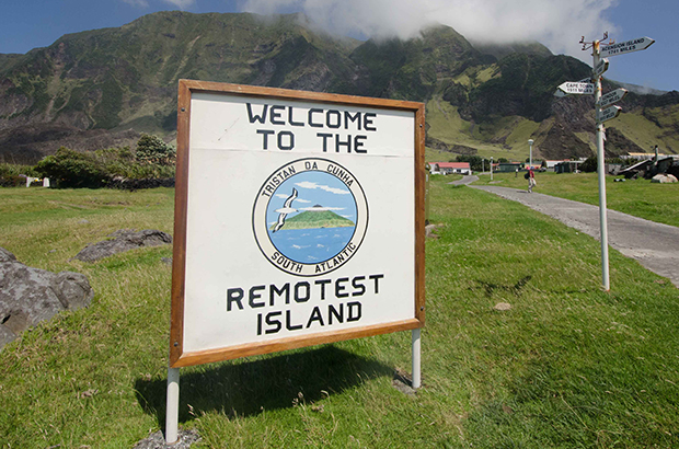
The most remote inhabited island on Earth
Situated midway between Brazil and South Africa in the South Atlantic Ocean, Tristan da Cunha is part of the Tristan archipelago and is the most remote inhabited island on Earth. The island has a population of only 260 inhabitants, but is surrounded by a 750,000 km2 exclusive economic zone, which spans a number of unique and rich ecosystems. These ecosystems support globally significant seabird populations, as well as hosting a small, local fishing industry. The Tristan archipelago is also home to a UNESCO World Heritage Site.
The Blue Belt programme is assisting local experts to protect this biodiversity whilst at the same time supporting the sustainable livelihoods of the island’s residents, for whom the fishing industry provides the island’s main source of revenue, jobs and food.
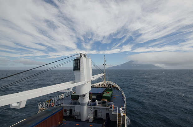
Our journey from Cape Town to the Tristan archipelago took 5 days aboard the vessel RMS St Helena. Unfortunately, we encountered some typically challenging South Atlantic weather when we approached the island’s capital – “Edinburgh of the Seven Seas”. We therefore had to remain sheltered between islands for several days before we could disembark.
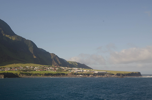
After getting ashore, Craig and I were met at Calshot Harbour by the Territory’s Administrator, Sean Burns. We then carried out an inspection of the island’s largest vessel, the Wave Dancer, which has an important role as a fisheries patrol boat.
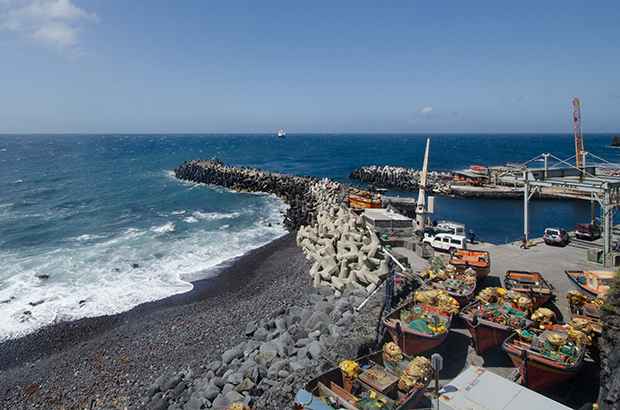
We also undertook a tour of the lobster processing plant in the company of Governor Lisa Phillips, Sean Burns and Warren Glass. Warren is an elected councillor and member of the Fisheries Department team. The plant plays a key role in supporting the MSC-certified Tristan lobster fishery and the tour gave us the chance to discuss fisheries and marine management issues with the Governor, Administrator and Warren.
Building partnerships and collaborations for a lasting legacy
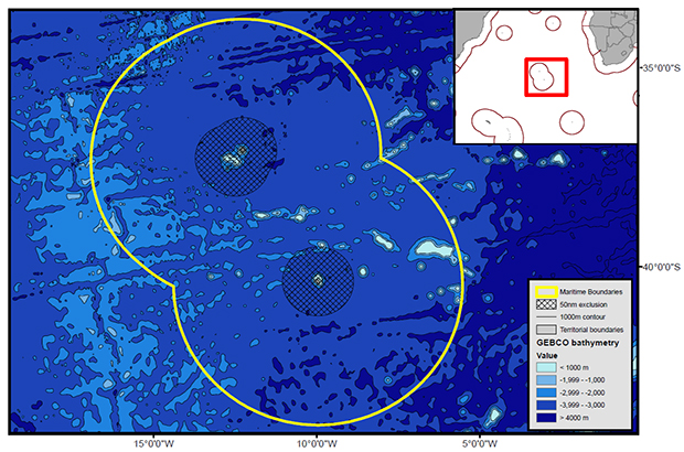
Satellite research that we commissioned in partnership with OceanMind and Catapult is also informing the work we are doing with the Island administration. The following heat map indicates the close proximity of the many transatlantic bulk carriers as they travel past the islands.
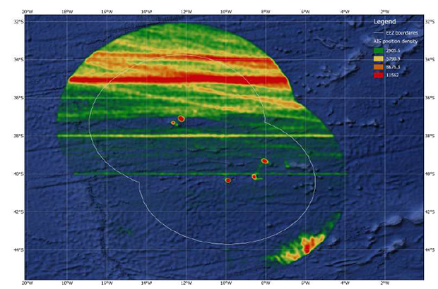
Working with the administration we are seeking to improve the management of the potential pollution risk of bulk carriers and transatlantic vessels running aground. This is a real risk, as seen in 2011, when the MS Oliva ran aground and leaked significant amounts of oil, resulting in damage to the delicate ecosystem.
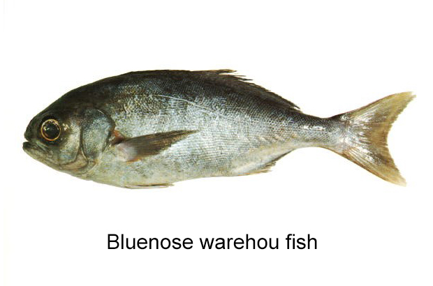
Craig McGarvey and I then headed towards St. Helena, while Oliver Yates remains on Tristan to work with the Fisheries and Conservation Departments on identifying areas in which further support is required to deliver sustainable fisheries management. Blue Belt experts will continue to work with their local counterparts on fisheries management, and carry out a monitoring trip aboard the longline vessel, tracking bluenose warehou fish later in February. Bluenose warehou are one of the three species of warehou in the waters around Tristan. The island supplies around 25% of the total global catch of this species. Monitoring the use of this resource will help ensure stocks are truly sustainable in the long-term.
Although brief, the visit to Tristan was extremely valuable, and enabled us to see the island first hand, discuss the programme with members of the community and local government. Further engagement activities and projects are now underway to integrate the knowledge and experience of community and local experts into the Blue Belt’s scientific investigations which are planned over the coming years. I hope these valuable partnerships will form the basis of a lasting legacy of collaboration and sustainability for the next generation of Tristan’s marine scientists.

Want to know more about the Blue Belt programme?
- Follow @ukgovbluebelt on Twitter
- Sign up to receive the e-newsletter
- Read the 'Introducing the Blue Belt Programme' publication
2 comments
Comment by Adrian Gahan posted on
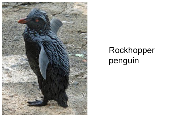
Perhaps worth noting that the rockhopper penguin in the photo above is covered in oil as a result of the Oliva spill. One of the reasons why the Tristanians are keen to protect their precious home!
Comment by Jake Turnbull, MMO posted on
Quite right, Adrian. And yes, that is, tragically, one of the Rockhopper penguins that was affected by the Oliva oil spill, and the photo is courtesy of the Tristan administration. The Blue Belt heat map also shows quite vividly just where the potential pressures are, in terms of the proximity of the current transatlantic container shipping routes. We're actively working with the overseas territories to address this issue, as well as the relevant international bodies and the industry. Best wishes, Jake